Latitude
Hey, I’m an old guy, give me some latitude!
When I was in grade school, there were these things on the wall called maps. They even had specific geographic names, like “Mercator Projection”, that we were supposed to memorize and understand. We were expected to compare and contrast the differences between these and other map projections; one of which is called a “Conic Projection,” I think. Maps seem a little ridiculous when you think about it – and now I’m quoting: “A geographical map represents an image of the earth’s surface following a specific focus and / or purpose (e.g. topographic, geological). One of the main challenges in creating maps is that the complexity of the earth’s surface can’t be exactly represented on a map. Maps therefore are an approximation of reality only.”
So here we were memorizing something that was only an approximation of reality? What’s the point? And what were all these lines running this way and that? Do you think if you asked 10 people on the street to define the difference between lines of longitude and latitude that even 5 of them would know the difference? Assuming you weren’t asking that question of US Naval Academy cadets, I bet only two or three would be able to answer that question correctly.
Even the wisenheimers who knew would get tripped up by specific names of latitudinal lines: Arctic Circle, Equator, Tropic of Cancer, Tropic of Capricorn! I always thought the Tropic of Cancer was a naughty book written by Henry Miller, but NO it actually exists. Who can remember that immortal phrase from American History that brought latitude to prominence: “54/40 or Fight!” the populist campaign slogan of James Polk, a relatively unknown candidate for president and widely considered a longshot to win the election?
Should he be elected, Polk threatened to go to war with the British unless the boundary line between the Oregon Territory (the states of Washington and Oregon, today) and British North America (now known as British Columbia and part of Canada) was drawn at latitude 54 degrees and 40 minutes north. Polk won against a far more experienced and capable opponent on the strength of this catchy media campaign. Seems like 1844 and 2016 have a lot more in common than we think.
What’s the significance of the 49th Parallel North? When Polk couldn’t get his way with the British Navy, he compromised and instead of 54/40, the boundary between the entire length of the United States and Canada became the 49th parallel latitude line. A more controversial latitude is the 38th Parallel which even today is the boundary line between North and South Korea. Technically, a state of war between the two countries still exists as the boundary is only part of an armistice agreement, not a formal treaty. When it became clear that the Chinese and American armies would be fighting endlessly on the Korean peninsula, wiser heads prevailed and the armistice ended hostilities, at least for a while. And the 38th parallel became the demilitarized zone between the two countries. Or one country with two contested regions. Or the Korean equivalent of mainland China and Taiwan as a conflict just waiting to happen.
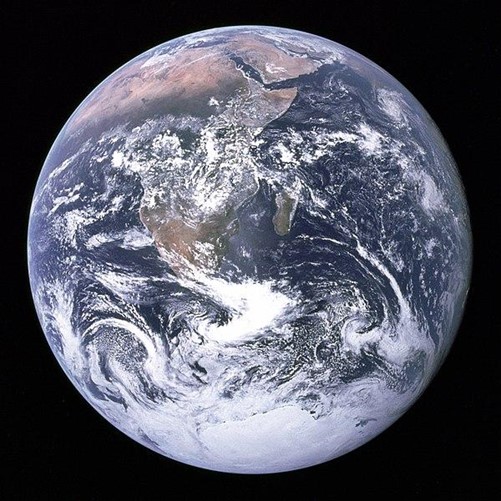
So now that Google and other mapping services have taken over the internet, maps are kind of a relic of the past, something only old people know about and mostly old men marvel over. We especially marvel at the free gas station maps that were given away with a few dollars of gas. You could measure the value of a road trip by the volume of free gas station maps overflowing the glove box. A really good trip, like the VW bus adventure that began in Orlando, Florida, continuing up the east coast to Poughkeepsie, New York before heading west to Pikes Peak (or bust), Colorado and then further west, north, east, and south with maps scattered everywhere in the front seat. But while paper maps are a thing of the past, globes of the planet will live on. For one thing, they’re cool, especially when lit from the inside. Also, unlike the maps, globes are far more accurate in describing land masses. Even when the boundaries of nations change, the sphere called Planet Earth will remain the same. Yarmouth, Maine is home to the world’s largest globe, Eartha, in the former home of the DeLorme mapping corporation. It’s 41 feet in diameter and weighs 5600 pounds. And, yes, at night the globe named Eartha is illuminated!! Why such a sight could make the journey to Yarmouth almost worthwhile. It’s probably the closest we can get to seeing this earthly home from outer space, the blue marble floating in the blackness of the void. Long after humans have left or been left behind, the marble will remain.
